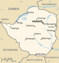
Maguta emuZimbabwe
Mataridziko

Maguta makuru
[chinjirudza | chinjirudza mabviro]| Maguta emuZimbabwe | |||||||
| Zvikamu | Guta | Huwandu | Province | Mufananidzo | |||
| Census 1982 | Census 1992 | Census 2002 | Est. 2007 | ||||
| 1. | Harare | 656,011 | 1,189,103 | 1,444,534 | 1,607,022 | Harare | 
|
| 2. | Bulawayo | 413,814 | 621,742 | 676,787 | 713,340 | Bulawayo | 
|
| 3. | Chitungwiza | 172,556 | 274,912 | 321,782 | 352,204 | Harare | |
| 4. | Mutare | 69,621 | 131,367 | 170,106 | 193,629 | Manicaland | 
|
| 5. | Gweru | 78,918 | 128,037 | 141,260 | 148,935 | Midlands | |
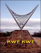
| 6. | Kwekwe | 47,607 | 75,425 | 93,072 | 103,210 | Midlands | 
|
| 7. | Kadoma | 44,613 | 67,750 | 76,173 | 81,008 | Mashonaland West | 
|
| 8. | Masvingo | 30,523 | 51,743 | 69,993 | 80,630 | Masvingo | |
| 9. | Chinhoyi | 24,322 | 43,054 | 56,794 | 65,109 | Mashonaland West | |
| 10. | Marondera | 19,971 | 39,384 | 52,283 | 60,291 | Mashonaland East | |
Maguta nemadhorobha emuZimbabwe nematunhu anotevera:
Manicaland
[chinjirudza | chinjirudza mabviro]- Birchenough Bridge
- Buhera
- Cashel
- Tizvione
- Chipinge
- Hauna
- Mutare (Provincial Town)
- Nyazura
- Rusape
- Nyanga
Mashonaland Central
[chinjirudza | chinjirudza mabviro]- Bindura
- Glendale, Zimbabwe
- Guruve
- Mount Darwin, Zimbabwe
- Bindura
- Mvurwi
- Shamva
- Matepatepa
- Rushinga
- Mazowe
Mashonaland East
[chinjirudza | chinjirudza mabviro]- Arcturus
- Beatrice
- Bromley
- Chitungwiza
- Marondera
- Ruwa
- Kotwa
- Chivhu
- Nharira
- Goromonzi
- Harare (Metropolitan Province)
- Macheke
- Mahusekwa
- Suswe
- Wedza
- Mutoko
- Murewa
- Epworth
- Juru
- Sadza
- Makosa
- Makaha
- Bondamakara
- Headlands
- Nyamapanda
Mashonaland West
[chinjirudza | chinjirudza mabviro]- Alaska
- Banket
- Battlefields
- Bumi Hills
- Cape Haig
- Chakari
- Charara
- Chegutu
- Chinhoyi (Provincial Capital)
- Chirundu
- Darwendale
- Doma
- Eiffel Flats
- Eldorado
- Feock
- Gadzema
- Golden Valley
- Kadoma
- Kariba
- Karoi
- Kildonan
- Lion's Den
- Madadzi
- Magunje
- Makuti
- Makwiro
- Mhangura
- Mubayira
- Munyati
- Muriel
- Murombedzi
- Mutorashanga
- Mwami
- Norton
- Orlando Heights
- Raffingora
- Sanyati
- Selous
- Shackleton
- Tashinga
- Tengwe
- Trelawney
- Umsweswe
- Unsworth
- Vanad
- Venice
- Vuti
- Zave
Masvingo
[chinjirudza | chinjirudza mabviro]- Bikita
- Bubye River
- Buffalo Range
- Chatsworth
- Chiredzi
- Chivi
- Felixburg
- Gaths Mine
- Glenclova
- Glenlivet
- Gutu
- Gurajena
- Gwengwerere Growth Point, Zimbabwe
- Hippo Valley
- Mabalauta
- Maranda
- Mashava
- Masvingo(Provincial Capital)
- Mbizi
- Mupandawana
- Mwenezi
- Ndanga [Alumanku]
- Nemanwa
- Ngomahuru
- Ngundu
- Renco
- Zimuto Siding
- Rutenga
- Sango
- Soti-Source
- Triangle
- Tswiza
- Zaka
- Musekiwa
Matabeleland North
[chinjirudza | chinjirudza mabviro]- Bembezi
- Binga
- Bulawayo (Metropolitan Province)
- Dagamela
- Deka Drum
- Dete
- Eastnor
- Hwange
- Inyati
- Kamativi
- Kariyangwe
- Kazungula
- Kenmaur
- Lonely Mine
- Lupane (Provincial Capital)
- Lusulu
- Matetsi
- Mlibizi
- Msuna
- Nkayi
- Ntabazinduna
- Nyamandhlovu
- Pandamatenga
- Queen's Mine
- Shangani
- Siabuwa
- Tsholotsho
- Tshotsholo
- Turk Mine
- Victoria Falls
Matabeleland South
[chinjirudza | chinjirudza mabviro]- Antelope Mine
- Beitbridge
- Blanket
- Colleen Bawn
- Esimbomvu
- Esigodini
- Figtree
- Filabusi
- Fort Rixon
- Fort Usher
- Gwanda (Provincial Capital)
- Kame
- Kezi
- Mangwe
- Maphisa
- Marula
- Mazunga
- Mbalabala
- Mphoengs
- Ngwesi
- Nsiza
- Plumtree
- Towla
- Tuli
- Vubachikwe
- West Nicholson
