
File:Cape Verde (orthographic projection).svg

Size of this PNG preview of this SVG file: 553 × 553 pixels. Zvimwe misimbiro: 240 × 240 pixels | 480 × 480 pixels | 768 × 768 pixels | 1,024 × 1,024 pixels | 2,048 × 2,048 pixels
Fayera repachivambo (SVG file, nominally 553 × 553 pixels, file size: 289 KB)
Muchipfupiso
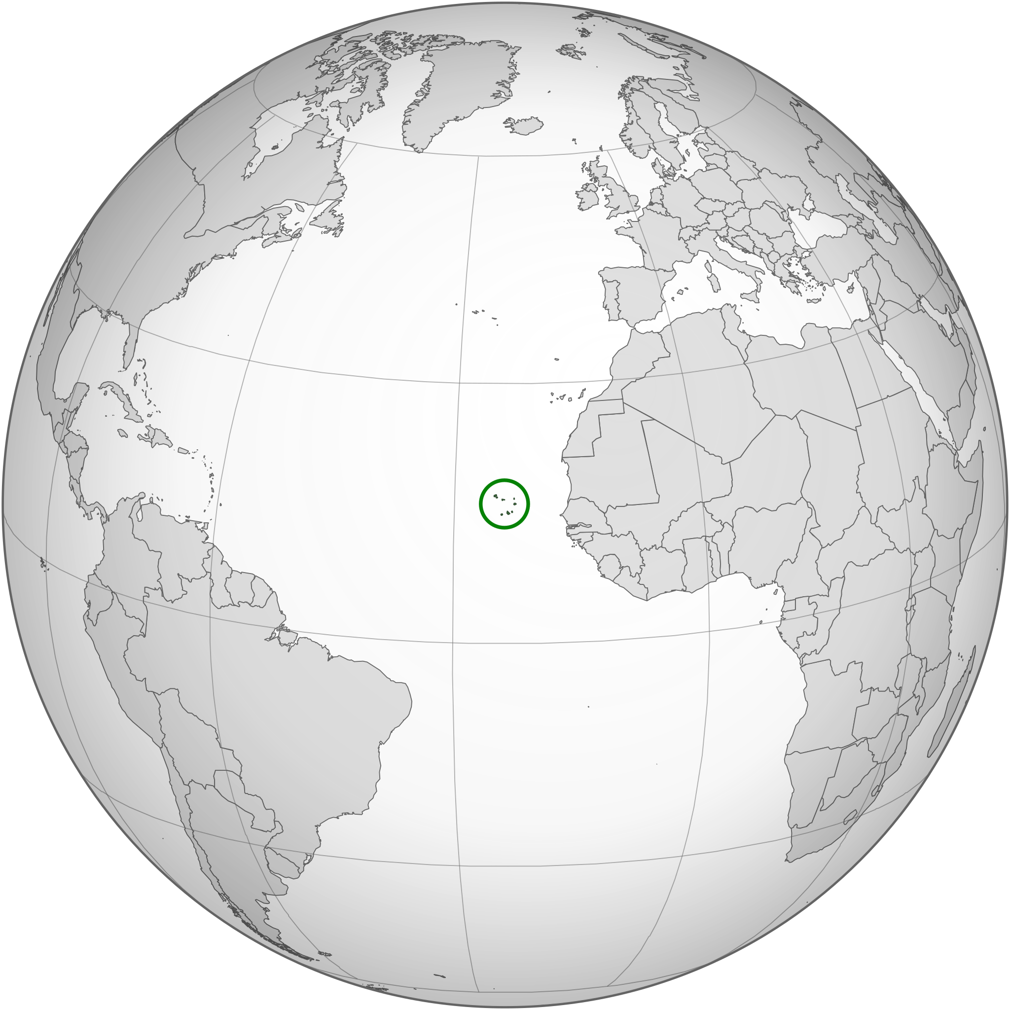
| Mutsananguro | Location of Cape Verde in the globe |
| Musi | |
| Mabviro | Own work based on: None (orthographic projection).svg and SVG-Koort Kap Verde.svg. |
| Munyori | Original: Waldyrious, New version: Flappiefh |
| Other versions |
.svg) |
| SVG genesis |
.svg)
.svg)
.svg)
.svg)
.svg)
.svg)
.svg)
.svg)
.svg)
.svg)
.svg)
.svg)
.svg)
.svg)
.svg)
.svg)
.svg)
.svg)
.svg)
.svg)
.svg)
.svg)
.svg)
.svg)
.svg)
.svg)
.svg)
.svg)
.svg)
.svg)
.svg)
.svg)
.svg)
.svg)
.svg)
.svg)
.svg)
.svg)
.svg)
.svg)
.svg)
.svg)
.svg)
.svg)
.svg)
.svg)
.svg)
.svg)
.svg)
.svg)
.svg)
.svg)
.svg)
.svg)
.svg)
.svg)
.svg)
.svg)
.svg)
.svg)
.svg)
.svg)
.svg)
.svg)
.svg)
.svg)
.svg)
.svg)
.svg)
.svg)
.svg)
.svg)
.svg)

.svg)

.svg)

.svg)
.svg)
.svg)
.svg)
.svg)
.svg)
.svg)


.svg)
.svg)
.svg)
.svg)
.svg)
.svg)
.svg)

.svg)
.svg)
.svg)
.svg)
.svg)
.svg)
.svg)
.svg)
.svg)

.svg)
.svg)
.svg)
.svg)
.svg)
.svg)
.svg)
_without_national_boundaries.svg)
.svg)
.svg)
.svg)
.svg)
.svg)
.svg)

.svg)
.svg)
.png)
.svg)
.svg)
.svg)
.svg)

.svg)
.svg)
.svg)
.svg)
.svg)
.svg)
.svg)
.svg)
.svg)
.svg)
.svg)

.svg)
.svg)
.svg)
.svg)
.svg)
.svg)
.svg)
.svg)
.svg)

.svg)
.svg)

.svg)
.svg)
.svg)
.svg)
.svg)
.svg)
.svg)
.svg)
.svg)
.svg)
.svg)
.svg)
.svg)
.svg)
.svg)
.svg)
.svg)
.svg)
.svg)
.svg)
.svg)
.svg)
.svg)
.svg)
.svg)
.svg)
.svg)
_-_Crimea_disputed.svg)
.svg)
.svg)
.svg)
.svg)
.svg)
.svg)
.svg)
.svg)
.svg)
.svg)
.svg)
_political.svg)
.svg)
.svg)
.svg)
.svg)
_-_Crimea_disputed_-_no_borders.svg)
.svg)
.svg)
.svg)
.svg)
.svg)
.svg)
.svg)
.svg)
.svg)
.svg)
.svg)

.svg)
.svg)
.svg)

.png)
.svg)
.svg)
.svg)
.svg)
.svg)
.svg)
.svg)
.svg)
.svg)
.svg)
.svg)
.svg)
.svg)
.svg)
.svg)
.svg)
.svg)
.svg)
.svg)
.svg)
.svg)
.svg)
.svg)
.svg)
.svg)
.svg)
.svg)
.svg)
.svg)
.svg)
.svg)
.svg)
.svg)
.svg)
.png)
.svg)
.svg)
.svg)
_(orthographic_projection).png)
.svg)
.svg)
Kurezinesa
I, the copyright holder of this work, hereby publish it under the following license:
This file is licensed under the Creative Commons Attribution-Share Alike 3.0 Unported license.
- Wakasungunuka:
- kugova – kucheza, kugovera ne kutumira basa
- kurhimikisa – kugadzirisa basa
- Pasi pemamiriro anotevera:
- Uzikano – Unofanhira kupa kiredhiti yakakodzeka, ipa kochekero yekune rezinesi, uye ratidza kana zvichinjirudzo zvaitwa. Ita sokudaro zviichienderana nenzira inonzwisisika, asi kwete nenzira ingaratidze zvekudii kuti murezinesi anokutsigira kana kushandiso kwako.
- gova saizvo – If you remix, transform, or build upon the material, you must distribute your contributions under the same or compatible license as the original.
Nhoroondo ye fayera
Dzvanya pa musi/nguva kuti uringe fayera sekuoneka kwaraita panguva iyoyo.
| Musi/Nguva | Mfananoudoko | Mitandu | Mushandisi | Komenda | |
|---|---|---|---|---|---|
| parizvino | 23:44, 16 Kurume 2015 | | 553 × 553 (289 KB) | Flappiefh | Removed Somaliland and Kosovo. Separated Western Sahara and Morroco. |
| 17:32, 30 Chikunguru 2013 |  | 553 × 553 (297 KB) | Flappiefh | Removed the unneeded green circle. | |
| 17:30, 30 Chikunguru 2013 |  | 553 × 553 (298 KB) | Flappiefh | South Sudan is now represented. The map has been redone thanks to gringer's Perlshaper tool. | |
| 06:53, 7 Gunyana 2010 |  | 650 × 650 (349 KB) | Waldyrious | Reverted to version as of 22:57, 18 June 2010. Proposed new version will be uploaded to separate filename | |
| 19:24, 6 Gunyana 2010 |  | 550 × 550 (664 KB) | Eddo | possible new version? | |
| 22:57, 18 Chikumi 2010 |  | 650 × 650 (349 KB) | Waldyrious | {{Information |Description=Location of Cape Verde in the globe |Source={{own}} |Date=2010-18-06 |Author=Waldir |Permission= |other_versions= }} |
Kushandiswa kwe fayera
The following page uses this file:
Kushandiswa kwe fayera pasirose
Mawiki anotevera ayo anoshandisa fayera iri:
- Hushandiso pa avk.wikipedia.org
- Hushandiso pa bg.wikipedia.org
- Hushandiso pa bi.wikipedia.org
- Hushandiso pa chr.wikipedia.org
- Hushandiso pa ckb.wikipedia.org
- Hushandiso pa el.wikipedia.org
- Hushandiso pa en.wikipedia.org
- Hushandiso pa en.wikinews.org
- Hushandiso pa es.wikipedia.org
- Hushandiso pa fa.wikipedia.org
- Hushandiso pa ff.wikipedia.org
- Hushandiso pa fr.wikipedia.org
- Hushandiso pa gcr.wikipedia.org
- Hushandiso pa he.wikipedia.org
- Hushandiso pa hu.wikipedia.org
- Hushandiso pa id.wikipedia.org
- Hushandiso pa ilo.wikipedia.org
- Hushandiso pa incubator.wikimedia.org
- Hushandiso pa is.wikipedia.org
- Hushandiso pa ja.wikipedia.org
- Hushandiso pa ka.wikipedia.org
- Hushandiso pa ky.wikipedia.org
- Hushandiso pa lt.wikipedia.org
- Hushandiso pa mg.wikipedia.org
- Hushandiso pa mi.wikipedia.org
- Hushandiso pa mn.wikipedia.org
- Hushandiso pa mt.wikipedia.org
- Hushandiso pa my.wikipedia.org
- Hushandiso pa ne.wikipedia.org
- Hushandiso pa no.wikipedia.org
- Hushandiso pa or.wikipedia.org
- Hushandiso pa pa.wikipedia.org
- Hushandiso pa pl.wikivoyage.org
- Hushandiso pa pl.wiktionary.org
Ringa kushandiswa kumwe kwe vupasirose kwe fayera rino.
.svg)
.svg)