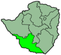
File:Zimbabwe Provinces Matabele South 250px.png

Zvirozvemo zvezanhi hazvitsigirwe mumimwe mitauro.
Kubva Wikipedia

Zimbabwe_Provinces_Matabele_South_250px.png(250 × 228 pixels, file size: 18 KB, MIME type: image/png)

Fayera rino rinobva kuWikimedia Commons uye rinogona kushandiswa nemimwe mwishumo. Mutsananguro uri pazanhi remutsananguro we fayera waro wakaratidzwa pazasi.

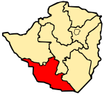
File:Province of Matabeleland South.svg is a vector version of this file. It should be used in place of this PNG file when not inferior.

File:Zimbabwe Provinces Matabele South 250px.png → File:Province of Matabeleland South.svg

For more information, see Help:SVG.

In other languages
Alemannisch  Bahasa Indonesia  Bahasa Melayu  British English  català  čeština  dansk  Deutsch  eesti  English  español  Esperanto  euskara  français  Frysk  galego  hrvatski  Ido  italiano  lietuvių  magyar  Nederlands  norsk bokmål  norsk nynorsk  occitan  Plattdüütsch  polski  português  português do Brasil  română  Scots  sicilianu  slovenčina  slovenščina  suomi  svenska  Tiếng Việt  Türkçe  vèneto  Ελληνικά  беларуская (тарашкевіца)  български  македонски  нохчийн  русский  српски / srpski  татарча/tatarça  українська  ქართული  հայերեն  বাংলা  தமிழ்  മലയാളം  ไทย  한국어  日本語  简体中文  繁體中文  עברית  العربية  فارسی  +/−
New SVG image

Muchipfupiso

Mutsananguro Map of the Matabele South Province in Zimbabwe; Created with the GIMP
Mabviro English Wikipedia
Munyori Sascha Noyes, 2004

Kurezinesa

w:en:Creative Commons
Uzikano gova saizvo
This file is licensed under the Creative Commons Attribution-Share Alike 3.0 Unported license. Subject to disclaimers.
Wakasungunuka:
  • kugova – kucheza, kugovera ne kutumira basa
  • kurhimikisa – kugadzirisa basa
Pasi pemamiriro anotevera:
  • Uzikano – Unofanhira kupa kiredhiti yakakodzeka, ipa kochekero yekune rezinesi, uye ratidza kana zvichinjirudzo zvaitwa. Ita sokudaro zviichienderana nenzira inonzwisisika, asi kwete nenzira ingaratidze zvekudii kuti murezinesi anokutsigira kana kushandiso kwako.
  • gova saizvo – If you remix, transform, or build upon the material, you must distribute your contributions under the same or compatible license as the original.
This licensing tag was added to this file as part of the GFDL licensing update.
GNU head Permission is granted to copy, distribute and/or modify this document under the terms of the GNU Free Documentation License, Version 1.2 or any later version published by the Free Software Foundation; with no Invariant Sections, no Front-Cover Texts, and no Back-Cover Texts. A copy of the license is included in the section entitled GNU Free Documentation License. Subject to disclaimers.

Captions

Add a one-line explanation of what this file represents

Items portrayed in this file

depicts Chirungu

copyrighted Chirungu

Nhoroondo ye fayera

Dzvanya pa musi/nguva kuti uringe fayera sekuoneka kwaraita panguva iyoyo.

Musi/NguvaMfananoudokoMitanduMushandisiKomenda
parizvino17:12, 28 Chikumi 2006Mfananoudoko weuhlovo sekubva 17:12, 28 Chikumi 2006250 × 228 (18 KB)Shauni{{Information |Description=Map of the Matabele South Province in Zimbabwe; Created with the GIMP |Source=English Wikipedia |Date= |Author=Sascha Noyes, 2004 |Permission= |other_versions= }} Category:Maps of Zimbabwe

There are no pages that use this file.