
File:Manicaland districts.png
Kukura kwe chipandwa ichi: 776 × 600 pixels Zvimwe misimbiro: 311 × 240 pixels | 621 × 480 pixels | 994 × 768 pixels | 1,056 × 816 pixels
Fayera repachivambo (1,056 × 816 pixels, file size: 33 KB, MIME type: image/png)
Muchipfupiso
| Mutsananguro |
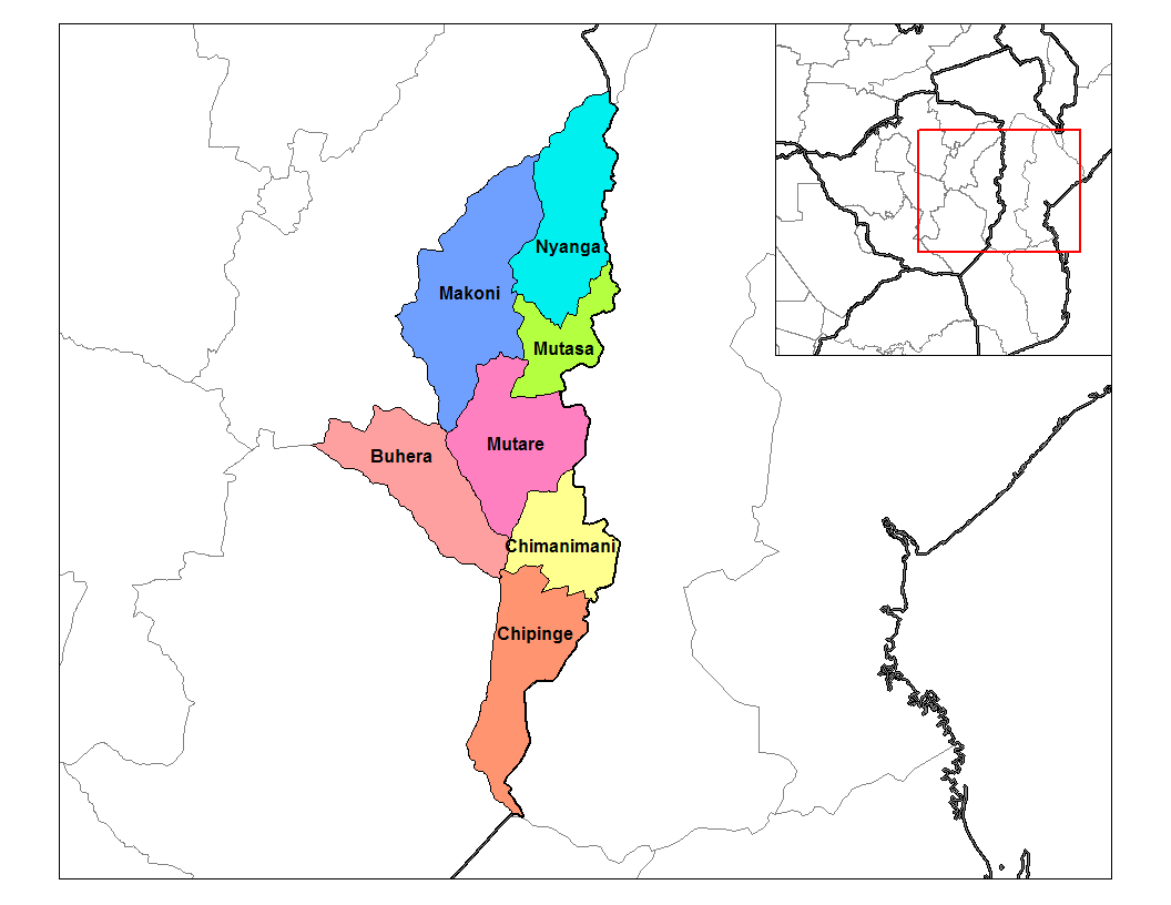
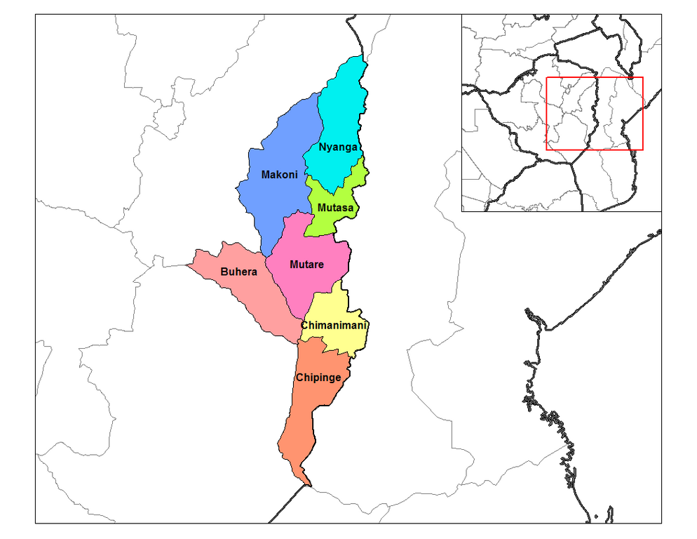
English: Map of the districts of Manicaland province of Zimbabwe. |
| Musi | 28 Gunyana 2006 (original upload date) |
| Mabviro |
Basa rangu (Rarelibra) using MapInfo Professional v8.5 and various mapping resources. |
| Munyori | Rarelibra at en.wikipedia |
Kurezinesa
| This work has been released into the public domain by its author, Rarelibra at Chirungu Wikipedhiya. This applies worldwide. In some countries this may not be legally possible; if so: Rarelibra grants anyone the right to use this work for any purpose, without any conditions, unless such conditions are required by law. |
Original upload log
The original description page was here. All following user names refer to en.wikipedia.
- 2006-09-28 18:28 Rarelibra 1056×816× (33900 bytes) Map of the districts of Manicaland province of Angola. Created by ~~~~ for public domain use, using MapInfo Professional v8.5 and various mapping resources.
Nhoroondo ye fayera
Dzvanya pa musi/nguva kuti uringe fayera sekuoneka kwaraita panguva iyoyo.
| Musi/Nguva | Mfananoudoko | Mitandu | Mushandisi | Komenda | |
|---|---|---|---|---|---|
| parizvino | 15:28, 10 Ndira 2011 | | 1,056 × 816 (33 KB) | Klik9 | {{Information |Description=Map of the districts of Manicaland province of Zimbabwe. |Source=Originally from [http://en.wikipedia.org en.wikipedia]; description page is (was) here |Date=2006 |Author=Rarelibra |Perm |
Kushandiswa kwe fayera
The following page uses this file:
Kushandiswa kwe fayera pasirose
Mawiki anotevera ayo anoshandisa fayera iri:
- Hushandiso pa ca.wikipedia.org
- Hushandiso pa en.wikipedia.org
- Hushandiso pa es.wikipedia.org
- Hushandiso pa frr.wikipedia.org
- Hushandiso pa ha.wikipedia.org
- Hushandiso pa ig.wikipedia.org
- Hushandiso pa it.wikipedia.org
- Hushandiso pa ja.wikipedia.org
- Hushandiso pa ka.wikipedia.org
- Hushandiso pa nl.wikipedia.org
- Hushandiso pa no.wikipedia.org
- Hushandiso pa pl.wikipedia.org
- Hushandiso pa pt.wikipedia.org
- Hushandiso pa ro.wikipedia.org
- Hushandiso pa ru.wikipedia.org
- Hushandiso pa tr.wikipedia.org
- Hushandiso pa ts.wikipedia.org
- Hushandiso pa uk.wikipedia.org
- Hushandiso pa ur.wikipedia.org
- Hushandiso pa www.wikidata.org
- Hushandiso pa yo.wikipedia.org
- Hushandiso pa zu.wikipedia.org