
File:Iran (orthographic projection).svg

Size of this PNG preview of this SVG file: 553 × 553 pixels. Zvimwe misimbiro: 240 × 240 pixels | 480 × 480 pixels | 768 × 768 pixels | 1,024 × 1,024 pixels | 2,048 × 2,048 pixels
Fayera repachivambo (SVG file, nominally 553 × 553 pixels, file size: 291 KB)
ععخه
Muchipfupiso
| Mutsananguro |
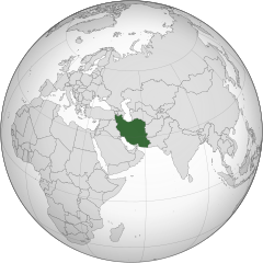
English: Iran
فارسی: ایران |
||||
| Musi | |||||
| Mabviro |
Basa rangu (Original text: Own work,)
|
||||
| Munyori | P30Carl | ||||
| Other versions |
.svg)
|
||||
| SVG genesis |
.svg)
.svg)
.svg)
.svg)
.svg)
.svg)
.svg)
.svg)
.svg)
.svg)
.svg)
.svg)
.svg)
.svg)
.svg)
.svg)
.svg)
.svg)
.svg)
.svg)
.svg)
.svg)
.svg)
.svg)
.svg)
.svg)
.svg)
.svg)
.svg)
.svg)
.svg)
.svg)
.svg)
.svg)
.svg)
.svg)
.svg)
.svg)
.svg)
.svg)
.svg)
.svg)
.svg)
.svg)
.svg)
.svg)
.svg)
.svg)
.svg)
.svg)
.svg)
.svg)
.svg)
.svg)
.svg)
.svg)
.svg)
.svg)
.svg)
.svg)
.svg)
.svg)
.svg)
.svg)
.svg)
.svg)
.svg)
.svg)
.svg)
.svg)
.svg)
.svg)
.svg)

.svg)

.svg)

.svg)
.svg)
.svg)
.svg)
.svg)
.svg)
.svg)


.svg)
.svg)
.svg)
.svg)
.svg)
.svg)
.svg)

.svg)
.svg)
.svg)
.svg)
.svg)
.svg)
.svg)
.svg)
.svg)

.svg)
.svg)
.svg)
.svg)
.svg)
.svg)
.svg)
_without_national_boundaries.svg)
.svg)
.svg)
.svg)
.svg)
.svg)
.svg)

.svg)
.svg)
.png)
.svg)
.svg)
.svg)
.svg)

.svg)
.svg)
.svg)
.svg)
.svg)
.svg)
.svg)
.svg)
.svg)
.svg)
.svg)

.svg)
.svg)
.svg)
.svg)
.svg)
.svg)
.svg)
.svg)
.svg)

.svg)
.svg)

.svg)
.svg)
.svg)
.svg)
.svg)
.svg)
.svg)
.svg)
.svg)
.svg)
.svg)
.svg)
.svg)
.svg)
.svg)
.svg)
.svg)
.svg)
.svg)
.svg)
.svg)
.svg)
.svg)
.svg)
.svg)
.svg)
.svg)
_-_Crimea_disputed.svg)
.svg)
.svg)
.svg)
.svg)
.svg)
.svg)
.svg)
.svg)
.svg)
.svg)
.svg)
_political.svg)
.svg)
.svg)
.svg)
.svg)
_-_Crimea_disputed_-_no_borders.svg)
.svg)
.svg)
.svg)
.svg)
.svg)
.svg)
.svg)
.svg)
.svg)
.svg)
.svg)

.svg)
.svg)
.svg)

.png)
.svg)
.svg)
.svg)
.svg)
.svg)
.svg)
.svg)
.svg)
.svg)
.svg)
.svg)
.svg)
.svg)
.svg)
.svg)
.svg)
.svg)
.svg)
.svg)
.svg)
.svg)
.svg)
.svg)
.svg)
.svg)
.svg)
.svg)
.svg)
.svg)
.svg)
.svg)
.svg)
.svg)
.svg)
.png)
.svg)
.svg)
.svg)
_(orthographic_projection).png)
.svg)
.svg)
.svg)
Kurezinesa
I, the copyright holder of this work, hereby publish it under the following licenses:
This file is licensed under the Creative Commons Attribution-Share Alike 3.0 Unported license.
- Wakasungunuka:
- kugova – kucheza, kugovera ne kutumira basa
- kurhimikisa – kugadzirisa basa
- Pasi pemamiriro anotevera:
- Uzikano – Unofanhira kupa kiredhiti yakakodzeka, ipa kochekero yekune rezinesi, uye ratidza kana zvichinjirudzo zvaitwa. Ita sokudaro zviichienderana nenzira inonzwisisika, asi kwete nenzira ingaratidze zvekudii kuti murezinesi anokutsigira kana kushandiso kwako.
- gova saizvo – If you remix, transform, or build upon the material, you must distribute your contributions under the same or compatible license as the original.

|
Permission is granted to copy, distribute and/or modify this document under the terms of the GNU Free Documentation License, Version 1.2 or any later version published by the Free Software Foundation; with no Invariant Sections, no Front-Cover Texts, and no Back-Cover Texts. A copy of the license is included in the section entitled GNU Free Documentation License. |
Unokwanisa kusarura rezinesi inoenderana nezvaunoda.
| Annotations | This image is annotated: View the annotations at Commons |
Nhoroondo ye fayera
Dzvanya pa musi/nguva kuti uringe fayera sekuoneka kwaraita panguva iyoyo.
| Musi/Nguva | Mfananoudoko | Mitandu | Mushandisi | Komenda | |
|---|---|---|---|---|---|
| parizvino | 23:32, 16 Kurume 2015 | | 553 × 553 (291 KB) | Flappiefh | Removed Somaliland and Kosovo. Separated Western Sahara and Morroco. |
| 12:27, 4 Nyamavhuvhu 2013 |  | 553 × 553 (295 KB) | Flappiefh | Added South Sudan. | |
| 08:03, 30 Nyamavhuvhu 2009 |  | 541 × 541 (749 KB) | P30Carl | {{Information |Description={{en|1=Iran}} {{fa|1=ایران}} |Source=Own work, {{Inkscape}}<br />[http://www.aquarius.geomar.de/omc/make_map.html Aquarius.geomar.de]<br />{{GFDL-GMT|migration=redundant}} |Author=P30Carl |Date=August 2009 |
Kushandiswa kwe fayera
The following page uses this file:
Kushandiswa kwe fayera pasirose
Mawiki anotevera ayo anoshandisa fayera iri:
- Hushandiso pa ady.wikipedia.org
- Hushandiso pa af.wikipedia.org
- Hushandiso pa ami.wikipedia.org
- Hushandiso pa arc.wikipedia.org
- Hushandiso pa ar.wikipedia.org
- إيران
- الدولة البهلوية
- ملوك فارس وإيران
- توقيت إيران
- قائمة الدول ذات السيادة والأقاليم التابعة في آسيا
- الحكومة الإيرانية المؤقتة
- قرار مجلس الأمن التابع للأمم المتحدة رقم 1696
- مستخدم:Alhassan Ehab/ملعب
- مستخدم:جار الله/قائمة صور مقالات العلاقات الثنائية
- العلاقات الأنغولية الإيرانية
- العلاقات الإيرانية الكورية الجنوبية
- العلاقات الإريترية الإيرانية
- العلاقات الإيرانية السويسرية
- العلاقات الإيرانية الليختنشتانية
- العلاقات الإيرانية البوليفية
- العلاقات الإيرانية الموزمبيقية
- العلاقات الألبانية الإيرانية
- العلاقات الإيرانية البلجيكية
- العلاقات الإثيوبية الإيرانية
- العلاقات الإيرانية البيلاروسية
- العلاقات الإيرانية الطاجيكية
- العلاقات الإيرانية الرومانية
- العلاقات الأرجنتينية الإيرانية
- العلاقات الإيرانية الغامبية
- العلاقات الإيرانية القبرصية
- العلاقات الإيرانية السيراليونية
- العلاقات الإيرانية النيبالية
- العلاقات الإيرانية الليبيرية
- العلاقات التشيكية الإيرانية
- العلاقات الإيرانية الميانمارية
- العلاقات الإيرانية الكندية
- العلاقات الإيرانية الزيمبابوية
- العلاقات الإيرانية البالاوية
- العلاقات الإيرانية المالية
- العلاقات الإيرانية النيجيرية
- العلاقات الإيرانية الفانواتية
- العلاقات الغابونية الإيرانية
- العلاقات الإيرانية البنمية
- العلاقات الإيرانية الكوبية
- العلاقات الإيرانية الجورجية
- العلاقات الإيرانية التونسية
- العلاقات الإيرانية الكورية الشمالية
- العلاقات الهندية الإيرانية
- العلاقات اليابانية الإيرانية
- العلاقات الإيرانية الإيطالية
- العلاقات الإيرانية الناوروية
Ringa kushandiswa kumwe kwe vupasirose kwe fayera rino.
.svg)
.svg)